2022 Map of Reeseville
USGS Topo · Published 2022About this map
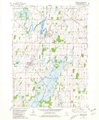
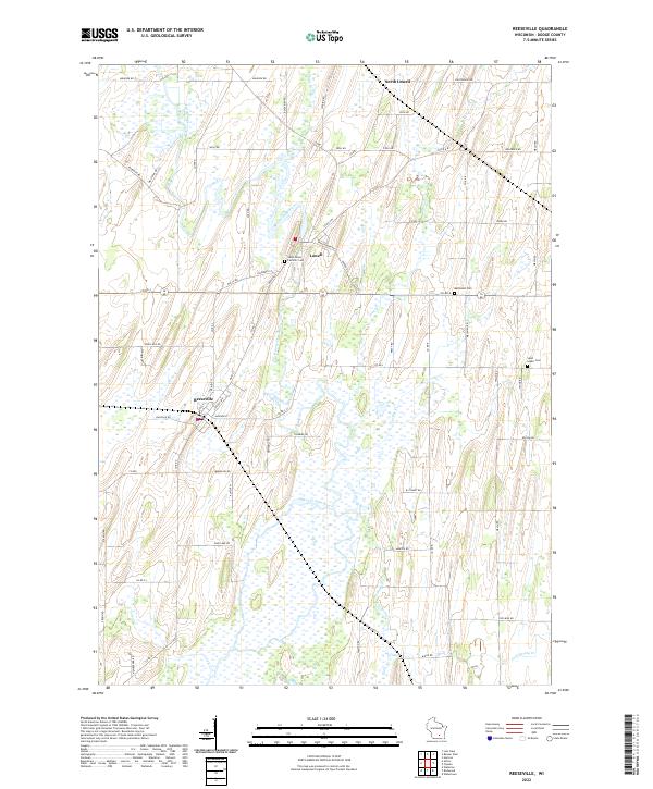
Beaver Dam River meanders through this portion of Dodge County, defining a landscape dominated by expansive wetlands and agricultural patterns in the early 21st century. The village of Reeseville serves as a primary hub, showing a structured grid of streets including Prairie St and Lincoln Ave. Further north, the town of Lowell sits near the riverbanks, with North Lowell located toward the upper margin of the survey. The mapping reveals a quiet rural character where local history is anchored by several burial sites, such as the Saint Johns Catholic Cem and the Methodist Cem. Numerous small waterways, including Pratt Cr, Clyman Cr, and Shaw Brook, feed into the central river system, illustrating the intricate drainage and hydrology of this Wisconsin lowland region.
Find a feature on this map
65 named features on this map. Tap any name to fly to it.
Don’t see what you’re looking for? This feature index may not catch every label — zoom into the map to look around manually.
Map Details
Editions of this 2022 Reeseville Map
This is the sole edition of this map. No revisions or reprints were ever made.