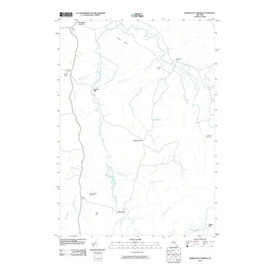
2010 Map of Remington Corners
USGS Topo · Published 2010About this map
Kimball Mill and Bishas Mill sit as prominent landmarks along the intricate river systems of northern New York. This area is defined by the branching waters of the West Branch Oswegatchie River and the Middle Branch Oswegatchie River, which carve through a landscape of named elevations like John Browns Mountain and Brushy Ridge. The settlement pattern is characterized by numerous crossroads communities, including Remington Corners, Tylers Corners, and Tinney Corners, suggesting a history of decentralized rural development tied to timber or water power. Small water bodies and tributaries like Norman Pond and Blue Swamp Creek feed into the larger river basins, while the presence of Jerden Falls indicates the natural drops in elevation that historically invited small-scale industrial sites in the Adirondack foothills.
Find a feature on this map
33 named features on this map. Tap any name to fly to it.
Don’t see what you’re looking for? This feature index may not catch every label — zoom into the map to look around manually.
Map Details
Editions of this 2010 Remington Corners Map
This is the sole edition of this map. No revisions or reprints were ever made.
Other maps of this area

1911 · Lowville
USGS Topo · 1:62,500

1912 · Number Four
USGS Topo · 1:62,500

1913 · Lowville
USGS Topo · 1:62,500

1913 · Lake Bonaparte
USGS Topo · 1:62,500

1915 · Number Four
USGS Topo · 1:62,500

1916 · Lake Bonaparte
USGS Topo · 1:62,500

1916 · Oswegatchie
USGS Topo · 1:62,500

1918 · Oswegatchie
USGS Topo · 1:62,500

1948 · Ogdensburg
USGS Topo · 1:250,000

1950 · Utica
USGS Topo · 1:250,000