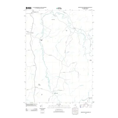
2013 Map of Remington Corners
USGS Topo · Published 2013About this map
The Adirondack foothills of Lewis County define this landscape, where the W Br Oswegatchie River and Middle Br Oswegatchie River weave through a network of ridges and settlements. This 2013 survey provides a detailed look at the rural intersection of timber and water, anchored by named localities such as Remington Corners and Jerden Falls. The map reveals the industrial legacies of the region through sites like Kimball Mill and Bishas Mill, while local family history is anchored at the Oswegatchie Corners Cem. Terrain features like Brushy Ridge, Grassy Hill, and Panther Mountain separate the various creek valleys, including Kimball Cr and Blanchard Cr. The road network, comprising routes like French Settlement Rd and Jerdens Falls Rd, connects isolated points like Middle Branch Corners and Dutton Corners, reflecting the persistent settlement patterns of northern New York.
Find a feature on this map
48 named features on this map. Tap any name to fly to it.
Don’t see what you’re looking for? This feature index may not catch every label — zoom into the map to look around manually.
Map Details
Editions of this 2013 Remington Corners Map
This is the sole edition of this map. No revisions or reprints were ever made.
Other maps of this area

1911 · Lowville
USGS Topo · 1:62,500

1912 · Number Four
USGS Topo · 1:62,500

1913 · Lowville
USGS Topo · 1:62,500

1913 · Lake Bonaparte
USGS Topo · 1:62,500

1915 · Number Four
USGS Topo · 1:62,500

1916 · Lake Bonaparte
USGS Topo · 1:62,500

1916 · Oswegatchie
USGS Topo · 1:62,500

1918 · Oswegatchie
USGS Topo · 1:62,500

1948 · Ogdensburg
USGS Topo · 1:250,000

1950 · Utica
USGS Topo · 1:250,000