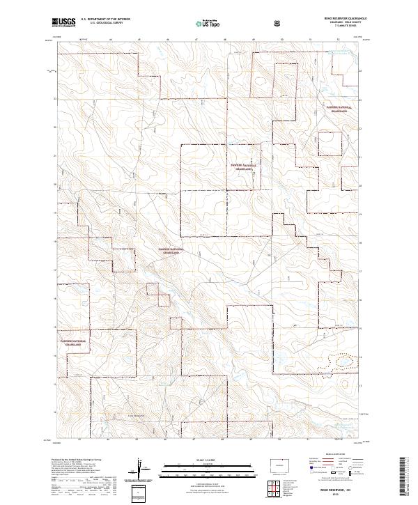
2022 Map of Reno Reservoir
USGS Topo · Published 2022About this map
The Pawnee National Grassland dominates this section of Weld County, defining a landscape marked by scattered water sources and expansive grazing lands. Topographic relief is most visible at Crow Valley Hill in the southwest, while the drainage of Geary Cr, Willow Cr, and Sand Cr provides a framework for the region's ranching infrastructure.
Find a feature on this map
22 named features on this map. Tap any name to fly to it.
Don’t see what you’re looking for? This feature index may not catch every label — zoom into the map to look around manually.
Map Details
Editions of this 2022 Reno Reservoir Map
This is the sole edition of this map. No revisions or reprints were ever made.
Other maps of this area

1908 · Eaton
USGS Topo · 1:125,000

1910 · Eaton
USGS Topo · 1:125,000

1954 · Greeley
USGS Topo · 1:250,000

1957 · Greeley
USGS Topo · 1:250,000

1958 · Greeley
USGS Topo · 1:250,000

1960 · Purcell
USGS Topo · 1:24,000

1961 · Greeley
USGS Topo · 1:250,000

1964 · Greeley
USGS Topo · 1:250,000

1965 · Greeley
USGS Topo · 1:250,000

1972 · Briggsdale
USGS Topo · 1:24,000