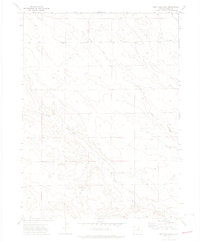
1972 Map of Reno Reservoir
USGS Topo · Published 1974About this map
Reno Reservoir sits in the high plains of Weld County, serving as a primary water management landmark in this expansive agricultural and ranching landscape. The terrain is defined by the drainage patterns of Geary Creek and Willow Creek, which carve distinct paths through the contours of northern Colorado. Recorded in the early 1970s, the map illustrates the sparse infrastructure of the region, where land use revolves around these vital water sources. Aside from the small-scale Spring and reservoir, the sheet preserves the location of scattered wells and section lines, providing a detailed record of the rural landscape before later developments or changes in land management. It reflects the intersection of natural hydrology and human resource engineering in a high-desert environment.
Find a feature on this map
4 named features on this map. Tap any name to fly to it.
Don’t see what you’re looking for? This feature index may not catch every label — zoom into the map to look around manually.
Map Details
Editions of this 1972 Reno Reservoir Map
This is the sole edition of this map. No revisions or reprints were ever made.
Other maps of this area

1908 · Eaton
USGS Topo · 1:125,000

1910 · Eaton
USGS Topo · 1:125,000

1954 · Greeley
USGS Topo · 1:250,000

1957 · Greeley
USGS Topo · 1:250,000

1958 · Greeley
USGS Topo · 1:250,000

1960 · Purcell
USGS Topo · 1:24,000

1961 · Greeley
USGS Topo · 1:250,000

1964 · Greeley
USGS Topo · 1:250,000

1965 · Greeley
USGS Topo · 1:250,000

1972 · Briggsdale
USGS Topo · 1:24,000