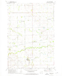
1973 Map of Revillo
USGS Topo · Published 1976About this map
The Yellow Bank River and its South Fork meander through the prairie landscape of eastern South Dakota, defining the agricultural and natural character of the region. The town of Revillo serves as a central hub, containing the Grant-Deuel Sch and the Revillo Cem. To the north, the smaller settlement of Albee is positioned along the Burlington Northern railroad, which historically facilitated the movement of grain and goods through this rural landscape.
Find a feature on this map
23 named features on this map. Tap any name to fly to it.
Don’t see what you’re looking for? This feature index may not catch every label — zoom into the map to look around manually.
Map Details
Editions of this 1973 Revillo Map
This is the sole edition of this map. No revisions or reprints were ever made.
Other maps of this area

1953 · Bellingham
USGS Topo · 1:62,500

1953 · Milbank
USGS Topo · 1:250,000

1953 · Watertown
USGS Topo · 1:250,000

1958 · Milbank
USGS Topo · 1:250,000

1958 · Watertown
USGS Topo · 1:250,000

1967 · Gary NW
USGS Topo · 1:24,000

1971 · Marietta
USGS Topo · 1:24,000

1971 · Rosen
USGS Topo · 1:24,000

1973 · LaBolt
USGS Topo · 1:24,000

1973 · Tunerville
USGS Topo · 1:24,000