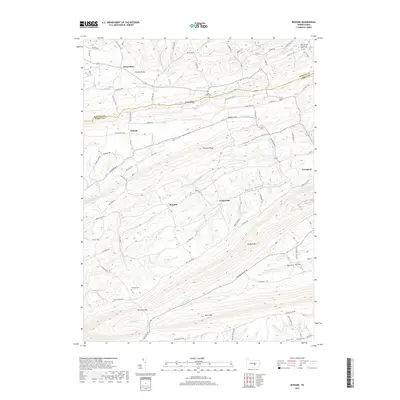
2019 Map of Reward
USGS Topo · Published 2019About this map
Turkey Valley and Pfoutz Valley dominate the northern landscape of this region along the border of Juniata and Perry Counties. The terrain is defined by a series of southwest-to-northeast ridges, including Turkey Ridge, Wildcat Ridge, and the prominent Berry Mtn at the southern edge. Small agricultural settlements like Seven Stars, Nekoda, and Reward are connected by a network of rural roads that follow the contours of the land, such as Sunbury Path and Perry Valley Rd. Local genealogy is anchored by several historic burial sites, including Saint James Cem near Turkey Ridge and Mitchell Cem in the shadow of Buffalo Mtn. Waterways such as Cocolamus Creek and Hunters Run carve through the ridges, creating notable features like Mitchell Gap. The map illustrates a traditional central Pennsylvania landscape where development remains concentrated in protected valleys between high timbered ridges.
Find a feature on this map
77 named features on this map. Tap any name to fly to it.
Don’t see what you’re looking for? This feature index may not catch every label — zoom into the map to look around manually.
Map Details
Editions of this 2019 Reward Map
This is the sole edition of this map. No revisions or reprints were ever made.
Other maps of this area

1892 · Harrisburg
USGS Topo · 1:62,500

1893 · Millersburg
USGS Topo · 1:62,500

1899 · Harrisburg
USGS Topo · 1:62,500

1907 · New Bloomfield
USGS Topo · 1:62,500

1907 · Millerstown
USGS Topo · 1:62,500

1924 · Harrisburg
USGS Topo · 1:62,500

1943 · Millerstown
USGS Topo · 1:62,500

1943 · Millersburg
USGS Topo · 1:62,500

1943 · Harrisburg
USGS Topo · 1:62,500

1943 · New Bloomfield
USGS Topo · 1:62,500
Featured Places
- Seven Stars, Greenwood Township
- Reward, Greenwood Township
- Pfoutz Valley, Liverpool Township
- Nekoda, Greenwood Township
- Centerville, Liverpool Township