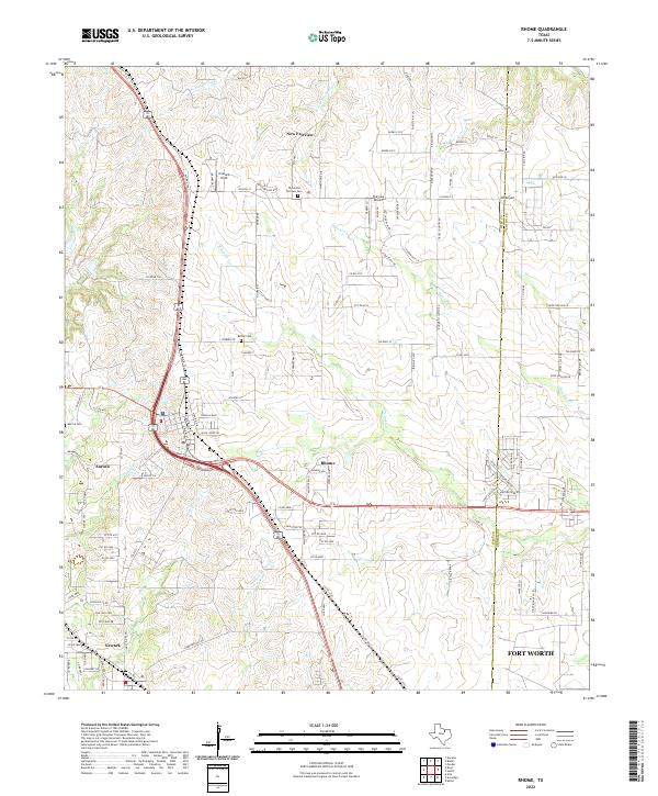
2022 Map of Rhome
USGS Topo · Published 2022About this map
Rhome and New Fairview anchor this Wise County landscape at a time of suburban expansion and historical preservation. The area is defined by a network of local roads and cattle-driving history, notably the Chisolm Trl and Old Chisholm Trl which cut through the western half of the map near Aurora. This mix of contemporary aviation sites like Fairview Airport and JW Airport alongside established burial grounds such as Thurmond Fairview Cem and Bethel Cem reflects the ongoing evolution of these North Texas prairie communities. Several watercourses, including Elizabeth Cr and Harriet Cr, drain the undulating terrain toward the Fort Worth metropolitan area just to the south. The transition from rural homesteads to modern developments is evident in the dense street grids appearing near Newark while large tracts of open land remain between the primary settlements.
Find a feature on this map
112 named features on this map. Tap any name to fly to it.
Don’t see what you’re looking for? This feature index may not catch every label — zoom into the map to look around manually.
Map Details
Editions of this 2022 Rhome Map
This is the sole edition of this map. No revisions or reprints were ever made.