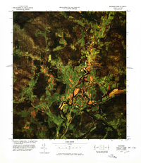
1977 Map of Richford Port of Entry
USGS Topo · Published 1978About this map
The Missisquoi River valley serves as the primary corridor for international transit and commerce in this 1970s orthophoto survey of the Vermont-Quebec border. Centered on the town of Richford, the landscape is a patchwork of agricultural clearings and dense timber, bisected by the Canada United States boundary line. This border is heavily monitored by several facilities including Richford Port of Entry U. S. Customs and Pinnacle Station U. S. Customs, highlighting the area's role as a vital crossing point.
Find a feature on this map
23 named features on this map. Tap any name to fly to it.
Don’t see what you’re looking for? This feature index may not catch every label — zoom into the map to look around manually.
Map Details
Editions of this 1977 Richford Port of Entry Map
This is the sole edition of this map. No revisions or reprints were ever made.
Other maps of this area

1919 · Montgomery
USGS Topo · 1:62,500

1920 · Franklin Pond
USGS Topo · 1:62,500

1920 · Montgomery
USGS Topo · 1:62,500

1922 · Enosburg Falls
USGS Topo · 1:48,000

1924 · Enosburg Falls
USGS Topo · 1:62,500

1925 · Jay Peak
USGS Topo · 1:62,500

1943 · Jay Peak
USGS Topo · 1:62,500

1944 · Enosburg Falls
USGS Topo · 1:62,500

1950 · Lake Champlain
USGS Topo · 1:250,000

1953 · Jay Peak
USGS Topo · 1:62,500