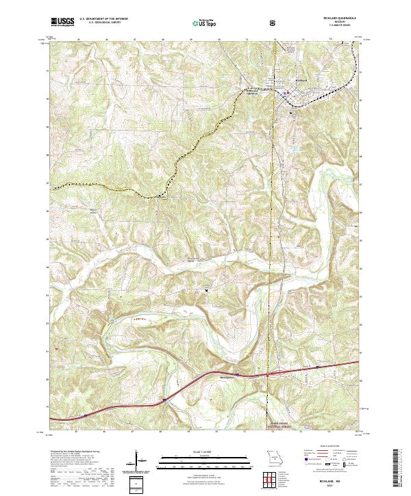
2021 Map of Richland
USGS Topo · Published 2021About this map
Richland sits at the northern edge of this Missouri landscape, where the BNSF Railway corridor and the Richland Municipal Airport serve as central points of transit. The map traces the winding course of the Gasconade River as it meanders through the southern half of the quadrangle, carving a path through the northern reaches of the Mark Twain National Forest. The terrain is defined by complex drainage patterns, with numerous hollows like Wilson Hollow and Cave Spring Hollow funneling water toward the river and its tributaries, including Cottonwood Cr and Bear Cr.
Find a feature on this map
70 named features on this map. Tap any name to fly to it.
Don’t see what you’re looking for? This feature index may not catch every label — zoom into the map to look around manually.
Map Details
Editions of this 2021 Richland Map
This is the sole edition of this map. No revisions or reprints were ever made.
Other maps of this area

1933 · Stoutland
USGS Topo · 1:62,500

1938 · Stoutland
USGS Topo · 1:62,500

1941 · Lebanon
USGS Topo · 1:62,500

1943 · Richland
USGS Topo · 1:62,500

1943 · Lebanon
USGS Topo · 1:62,500

1943 · Drynob
USGS Topo · 1:62,500

1954 · Springfield
USGS Topo · 1:250,000

1954 · Drynob
USGS Topo · 1:62,500
1954 · Richland
USGS Topo · 1:62,500
1954 · Richland
USGS Topo · 1:24,000