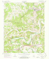
1954 Map of Richland
USGS Topo · Published 1977About this map
Richland sits as a regional hub in the northern section of this survey, where the St Louis San Francisco railroad and the Municipal Airport anchor the local economy. The landscape is defined by the winding course of the Gasconade River as it cuts through the southern half of the quadrangle, creating a focus for seasonal recreation at spots like Wildwood Resort, Riverside Lodge, and Gasconade Hills Resort. These riverside sites reflect a mid-century shift toward tourism and leisure in this Missouri corridor.
Find a feature on this map
35 named features on this map. Tap any name to fly to it.
Don’t see what you’re looking for? This feature index may not catch every label — zoom into the map to look around manually.
Map Details
Editions of this 1954 Richland Map
2 editions found
Other maps of this area

1933 · Stoutland
USGS Topo · 1:62,500

1938 · Stoutland
USGS Topo · 1:62,500

1941 · Lebanon
USGS Topo · 1:62,500

1943 · Richland
USGS Topo · 1:62,500

1943 · Lebanon
USGS Topo · 1:62,500

1943 · Drynob
USGS Topo · 1:62,500

1954 · Springfield
USGS Topo · 1:250,000

1954 · Drynob
USGS Topo · 1:62,500
1954 · Richland
USGS Topo · 1:62,500
1954 · Richland
USGS Topo · 1:24,000