
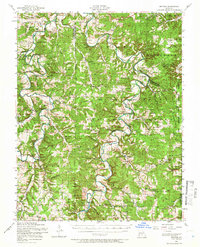
1954 Map of Drynob
USGS Topo · Published 1958About this map
The Gasconade River and Osage Fork define the topography of this mid-Missouri landscape within the Mark Twain National Forest. In the mid-1950s, the area was a network of small upland settlements like Drynob, Winnipeg, and Agnes, connected by river crossings such as the Hall Ford Bridge and Lambeth Bridge. The map records a transition in rural education and community life, marking several locations like Prairie Creek School and Stockdale School as abandoned, while institutions like Brownfield School and the Brownfield Missionary Church remained active. Genealogists will find a high density of family-named burial grounds, including Similin Cemetery, Cook Cemetery, and Jackson Cemetery. The eastern edge of the quadrangle is notably occupied by the boundary of the Fort Leonard Wood Military Reservation, which meets the rugged terrain of Roubidoux Creek.
Find a feature on this map
89 named features on this map. Tap any name to fly to it.
Don’t see what you’re looking for? This feature index may not catch every label — zoom into the map to look around manually.
Map Details
Editions of this 1954 Drynob Map
2 editions found
Other maps of this area

1931 · Manes
USGS Topo · 1:48,000

1933 · Stoutland
USGS Topo · 1:62,500

1936 · Waynesville
USGS Topo · 1:48,000

1938 · Stoutland
USGS Topo · 1:62,500

1941 · Big Piney
USGS Topo · 1:62,500

1941 · Manes
USGS Topo · 1:62,500

1941 · Lebanon
USGS Topo · 1:62,500

1941 · Bado
USGS Topo · 1:62,500

1942 · Waynesville
USGS Topo · 1:62,500

1943 · Richland
USGS Topo · 1:62,500