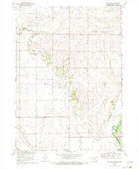
1969 Map of Richland
USGS Topo · Published 1971About this map
Brule Creek meanders through the heart of this Union County landscape, serving as a primary drainage corridor toward the Big Sioux River at the southeastern corner. The agricultural character of Spink and Richland is evident through the dense network of rural infrastructure, including localized schools such as Spink Sch and Coyote Sch. This late-1960s survey documents a community tied to the land and its history, marked by numerous religious and memorial sites like Pleasant Hill Chapel, Brule Creek Ch, and the Old Brule Creek Cem.
Find a feature on this map
26 named features on this map. Tap any name to fly to it.
Don’t see what you’re looking for? This feature index may not catch every label — zoom into the map to look around manually.
Map Details
Editions of this 1969 Richland Map
This is the sole edition of this map. No revisions or reprints were ever made.
Other maps of this area

1898 · Elk Point
USGS Topo · 1:125,000

1901 · Elk Point
USGS Topo · 1:125,000

1907 · Elk Point
USGS Topo · 1:125,000

1955 · Sioux City
USGS Topo · 1:250,000

1958 · Sioux City
USGS Topo · 1:250,000

1959 · Sioux City
USGS Topo · 1:250,000

1963 · Elk Point
USGS Topo · 1:24,000

1963 · Elk Point NE
USGS Topo · 1:24,000

1964 · Burbank
USGS Topo · 1:24,000
1969 · Chatsworth
USGS Topo · 1:24,000