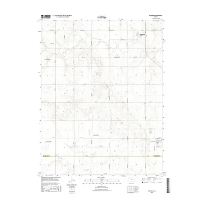
2016 Map of Richmond
USGS Topo · Published 2016About this map
The town of Richmond sits at the intersection of a sprawling road network along the southern border of Franklin Co Anderson Co. This 2016 survey highlights a landscape defined by traditional section lines and agricultural allotments, including the specifically named Farmers Field near the center of the sheet. To the north, the village of Princeton is situated among the headwaters of Middle Cr and Payne Cr, while the southern reaches of the map are drained by Sac Cr. Geographers can observe the natural shifts in local hydrology through the Old Channel Sac Creek, which remains visible as the modern stream course winds through the township. The infrastructure is characterized by roads named for American states and historical figures, such as John Brown Rd, Eisenhower Rd, and Kentucky Rd.
Find a feature on this map
42 named features on this map. Tap any name to fly to it.
Don’t see what you’re looking for? This feature index may not catch every label — zoom into the map to look around manually.
Map Details
Editions of this 2016 Richmond Map
This is the sole edition of this map. No revisions or reprints were ever made.
Other maps of this area

1885 · Garnett
USGS Topo · 1:125,000

1885 · Lawrence
USGS Topo · 1:125,000

1889 · Lawrence
USGS Topo · 1:125,000

1894 · Garnett
USGS Topo · 1:125,000

1947 · Lawrence
USGS Topo · 1:250,000

1950 · Lawrence
USGS Topo · 1:250,000

1956 · Pomona
USGS Topo · 1:24,000

1956 · Williamsburg
USGS Topo · 1:24,000

1956 · Ottawa South
USGS Topo · 1:24,000

1956 · Lawrence
USGS Topo · 1:250,000