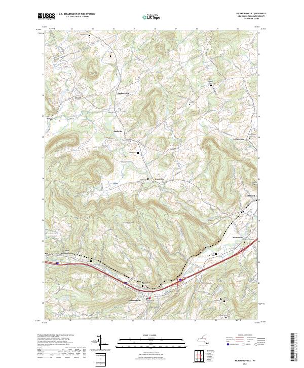
2023 Map of Richmondville
USGS Topo · Published 2023About this map
Cobleskill Creek and West Creek define the drainage of this Schoharie County landscape, where the village of Richmondville serves as a primary hub for the surrounding rural valleys. The area is characterized by numerous family-named landmarks and historical burial grounds, including the Richmondville Rural Cem and the Richmondville Village Cem. Smaller clusters of settlement such as Seward, Hyndsville, and Lawyersville are linked by a network of winding roads like the Loonenburg Tpke and Janesville Ln. In the eastern portion of the map, the landscape rises toward Mount Shank, while the southern reaches are marked by the steep terrain of Beards Hollow and Brooker Hollow. The presence of several distinct cemeteries, such as the New Rhinebeck Cem and Strobeck Cem, provides a detailed record of local genealogy and nineteenth-century community centers that persist into the modern era.
Find a feature on this map
106 named features on this map. Tap any name to fly to it.
Don’t see what you’re looking for? This feature index may not catch every label — zoom into the map to look around manually.
Map Details
Editions of this 2023 Richmondville Map
This is the sole edition of this map. No revisions or reprints were ever made.
Other maps of this area

1896 · Fonda
USGS Topo · 1:62,500

1898 · Fonda
USGS Topo · 1:62,500

1898 · Canajoharie
USGS Topo · 1:62,500

1898 · Schoharie
USGS Topo · 1:62,500

1900 · Canajoharie
USGS Topo · 1:62,500

1900 · Schoharie
USGS Topo · 1:62,500

1902 · Canajoharie
USGS Topo · 1:62,500

1902 · Fonda
USGS Topo · 1:62,500

1904 · Richmondville
USGS Topo · 1:62,500

1943 · Cobleskill
USGS Topo · 1:24,000