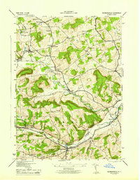
1945 Map of Richmondville
USGS Topo · Published 1945About this map
Richmondville serves as the primary hub of this Schoharie County survey, with the Central School and local street grid defining the village center at the base of Brooker Hollow. The landscape is characterized by a dense network of numbered school districts, such as School No 10 and School No 12, which mark the rural social geography of the mid-1940s. These schools, paired with family-named landmarks like Zeh Corners and Gardnersville, reflect a settled upland farming economy where every few miles of road served a distinct neighborhood cluster.
Find a feature on this map
41 named features on this map. Tap any name to fly to it.
Don’t see what you’re looking for? This feature index may not catch every label — zoom into the map to look around manually.
Map Details
Editions of this 1945 Richmondville Map
This is the sole edition of this map. No revisions or reprints were ever made.
Other maps of this area

1896 · Fonda
USGS Topo · 1:62,500

1898 · Fonda
USGS Topo · 1:62,500

1898 · Canajoharie
USGS Topo · 1:62,500

1898 · Schoharie
USGS Topo · 1:62,500

1900 · Canajoharie
USGS Topo · 1:62,500

1900 · Schoharie
USGS Topo · 1:62,500

1902 · Canajoharie
USGS Topo · 1:62,500

1902 · Fonda
USGS Topo · 1:62,500

1904 · Richmondville
USGS Topo · 1:62,500

1943 · Cobleskill
USGS Topo · 1:24,000