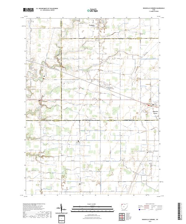
2023 Map of Ridgeville Corners
USGS Topo · Published 2023About this map
Archbold and Ridgeville Corners anchor this rural landscape where the boundaries of Fulton, Henry, Williams, and Defiance counties converge. The terrain is defined by a dense grid of township and county roads, reflecting the persistent agricultural character of Northwest Ohio. Significant educational infrastructure is present at Northwest State Community College, situated along the Bryan-Napoleon Rd. Numerous historic burying grounds are scattered across the quadrangle, including Saint Johns Cem, Locust Grove Cem, and Saint Marks Lutheran Cem, providing vital reference points for local genealogists. The natural drainage of the region is traced by the winding paths of Owl Creek, Coon Creek, and Garrett Creek, which cut through the predominantly flat farm acreage. Modern transportation corridors like US Rte 6 and Nolan Pkwy facilitate regional travel through this traditional farming belt.
Find a feature on this map
82 named features on this map. Tap any name to fly to it.
Don’t see what you’re looking for? This feature index may not catch every label — zoom into the map to look around manually.
Map Details
Editions of this 2023 Ridgeville Corners Map
This is the sole edition of this map. No revisions or reprints were ever made.
Other maps of this area

1907 · Defiance
USGS Topo · 1:62,500

1908 · Napoleon
USGS Topo · 1:62,500

1909 · Defiance
USGS Topo · 1:62,500

1911 · Wauseon
USGS Topo · 1:62,500

1913 · Wauseon
USGS Topo · 1:62,500

1913 · Alvordton
USGS Topo · 1:62,500

1943 · Wauseon
USGS Topo · 1:62,500

1944 · Alvordton
USGS Topo · 1:62,500

1953 · Fort Wayne
USGS Topo · 1:250,000

1956 · Fort Wayne
USGS Topo · 1:250,000