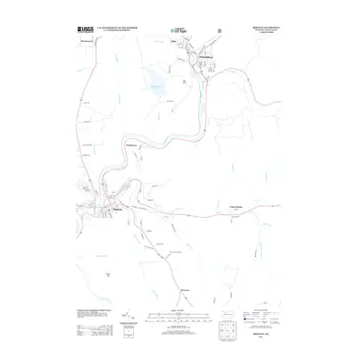
2013 Map of Ridgway
USGS Topo · Published 2013About this map
Ridgway and Johnsonburg anchor this 2013 survey of the Elk County highlands, where the Clarion River winds through narrow valleys. The map documents the intricate street grids of these industrial river towns, showing the dense network of local routes like River Ave and Glen Mayo Rd. Between these population centers, the landscape is defined by its drainages, including Elk Cr and Gallagher Run, and significant infrastructure like the Sedimentation Reservoir and the Boot Jack Fire Tower. Smaller communities such as Whistletown, Rolfe, and Daguscahonda appear as distinct pockets of settlement linked by winding mountain roads. The presence of an Old RR near the southeastern corner provides a marker of former industrial transit routes that once served the region's timber or mining sectors.
Find a feature on this map
94 named features on this map. Tap any name to fly to it.
Don’t see what you’re looking for? This feature index may not catch every label — zoom into the map to look around manually.
Map Details
Editions of this 2013 Ridgway Map
This is the sole edition of this map. No revisions or reprints were ever made.
Other maps of this area

1934 · Kane
USGS Topo · 1:48,000

1935 · Mt. Jewett
USGS Topo · 1:48,000

1939 · Kane
USGS Topo · 1:62,500

1940 · Hallton
USGS Topo · 1:48,000

1940 · Mt. Jewett
USGS Topo · 1:62,500

1941 · Ridgway
USGS Topo · 1:62,500

1943 · Hallton
USGS Topo · 1:62,500

1944 · Ridgway
USGS Topo · 1:62,500

1957 · Warren
USGS Topo · 1:250,000

1958 · Warren
USGS Topo · 1:250,000