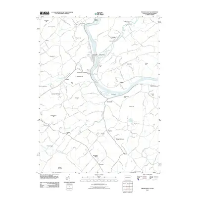
2011 Map of Riegelsville
USGS Topo · Published 2011About this map
The Delaware River serves as the central artery for this region on the border of Pennsylvania and New Jersey, where the Musconetcong River and Cooks Creek converge with the primary waterway. Industrial history is evident near Riegelsville and Durham Furnace, where the Durham Paper Company Dam and Finesville Dam mark long-standing water-power sites. The landscape is defined by significant elevations such as Hexenkopf Hill, Mount Joy, and the dramatic Nockamixon Cliffs overlooking the river. Local infrastructure is anchored by landmarks like Haupts Mill Bridge and the Cedar Acres Airport further south near Revere. Genealogists may find value in the documented locations of Union Cemetery and Nockamixon Cemetery, which serve the various small crossroad settlements including Kintnersville, Ferndale, and Stouts Valley.
Find a feature on this map
170 named features on this map. Tap any name to fly to it.
Don’t see what you’re looking for? This feature index may not catch every label — zoom into the map to look around manually.
Map Details
Editions of this 2011 Riegelsville Map
This is the sole edition of this map. No revisions or reprints were ever made.
Other maps of this area

1888 · Quakertown
USGS Topo · 1:62,500

1890 · Easton
USGS Topo · 1:62,500

1890 · Doylestown
USGS Topo · 1:62,500

1890 · Quakertown
USGS Topo · 1:62,500

1891 · Easton
USGS Topo · 1:62,500

1891 · Doylestown
USGS Topo · 1:62,500

1894 · Allentown
USGS Topo · 1:62,500

1894 · Quakertown
USGS Topo · 1:62,500

1932 · Easton
USGS Topo · 1:62,500

1939 · Allentown
USGS Topo · 1:62,500