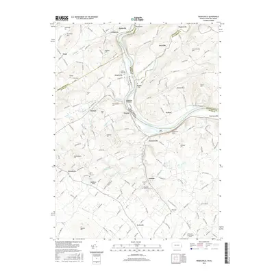
2016 Map of Riegelsville
USGS Topo · Published 2016About this map
The Delaware River serves as a central artery for this borderland where Pennsylvania and New Jersey meet, framed by a series of prominent peaks and ridges. The industrial legacy of the region is anchored by Durham Furnace and nearby Mine Hill, reflecting the historical mineral wealth of the valley. Settlement patterns are concentrated in riverfront towns like Riegelsville and Raubsville, while smaller hamlets such as Durham and Kintnersville dot the interior. Genealogical value is high throughout the quadrangle, with several established burial sites including the Union / Riegelsville Union Cem and the Gallows Hill Graveyard. The topography is defined by significant elevations like Musconetcong Mtn and Hexenkopf Hill, while the Musconetcong River joins the Delaware from the east near Finesville, marking the boundary between Warren and Hunterdon counties.
Find a feature on this map
163 named features on this map. Tap any name to fly to it.
Don’t see what you’re looking for? This feature index may not catch every label — zoom into the map to look around manually.
Map Details
Editions of this 2016 Riegelsville Map
This is the sole edition of this map. No revisions or reprints were ever made.
Other maps of this area

1888 · Quakertown
USGS Topo · 1:62,500

1890 · Easton
USGS Topo · 1:62,500

1890 · Doylestown
USGS Topo · 1:62,500

1890 · Quakertown
USGS Topo · 1:62,500

1891 · Easton
USGS Topo · 1:62,500

1891 · Doylestown
USGS Topo · 1:62,500

1894 · Allentown
USGS Topo · 1:62,500

1894 · Quakertown
USGS Topo · 1:62,500

1932 · Easton
USGS Topo · 1:62,500

1939 · Allentown
USGS Topo · 1:62,500