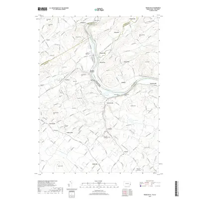
2019 Map of Riegelsville
USGS Topo · Published 2019About this map
Riegelsville sits at the heart of this landscape where the Delaware River separates Pennsylvania and New Jersey, joined by the Musconetcong River flowing in from the northeast. The terrain is defined by a series of prominent rises including Musconetcong Mtn, Mount Joy, and Rattlesnake Hill, which shaped the early development of industrial and agricultural hamlets. The settlement pattern reflects a long history of resource extraction and transport, evidenced by the location of Durham Furnace and Mine Hill near the riverbanks.
Find a feature on this map
178 named features on this map. Tap any name to fly to it.
Don’t see what you’re looking for? This feature index may not catch every label — zoom into the map to look around manually.
Map Details
Editions of this 2019 Riegelsville Map
This is the sole edition of this map. No revisions or reprints were ever made.
Other maps of this area

1888 · Quakertown
USGS Topo · 1:62,500

1890 · Easton
USGS Topo · 1:62,500

1890 · Doylestown
USGS Topo · 1:62,500

1890 · Quakertown
USGS Topo · 1:62,500

1891 · Easton
USGS Topo · 1:62,500

1891 · Doylestown
USGS Topo · 1:62,500

1894 · Allentown
USGS Topo · 1:62,500

1894 · Quakertown
USGS Topo · 1:62,500

1932 · Easton
USGS Topo · 1:62,500

1939 · Allentown
USGS Topo · 1:62,500