Loading...
Loading map...2022 Map of Riesel
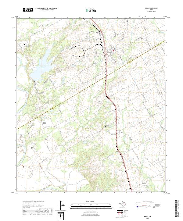
USGS Topo · Published 2022About this map
Riesel and the neighboring community of Perry define the settled corridor along the county line between McLennan and Falls counties. This landscape is a patchwork of rural homesteads and agricultural roads, where local life is anchored by historic burial grounds and places of worship. Genealogists will find a wealth of data in sites like Springhill United Methodist Church Cem, Trinity Lutheran Cem, and the Saint Paul Cem, which reflect the diverse denominational history of the region.
Find a feature on this map
95 named features on this map. Tap any name to fly to it.
Don’t see what you’re looking for? This feature index may not catch every label — zoom into the map to look around manually.
Map Details
Date Portrayed2022
Date Published2022
PublisherU.S. Geological Survey
Map TypeTopographic
Scale1:24000
Physical Dimensions24 x 29 inches
Editions of this 2022 Riesel Map
This is the sole edition of this map. No revisions or reprints were ever made.
Historical Maps of Perry Through Time
Featured Locations
Source Details
SourceU.S. Geological Survey
CopyrightPublic Domain