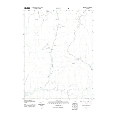
2011 Map of Rifle Falls
USGS Topo · Published 2011About this map
East Rifle Creek carves a central path through this Garfield County landscape, feeding the well-known Rifle Falls and the adjacent Rifle Falls Fish Hatchery. The map reveals a high concentration of mining history nestled within the canyon walls and plateaus, including the Lily Mine, Sunshine Mine, and Grandview Mine grouped together north of the falls. Further south, the Garfield Mine and Rifle Mine sit above the valley floor, indicating the area's long-standing connection to mineral extraction.
Find a feature on this map
51 named features on this map. Tap any name to fly to it.
Don’t see what you’re looking for? This feature index may not catch every label — zoom into the map to look around manually.
Map Details
Editions of this 2011 Rifle Falls Map
This is the sole edition of this map. No revisions or reprints were ever made.
Other maps of this area

1906 · Grand Hogback
USGS Topo · 1:125,000

1910 · Grand Hogback
USGS Topo · 1:125,000

1952 · Horse Mountain
USGS Topo · 1:24,000

1952 · Rifle
USGS Topo · 1:24,000

1957 · Leadville
USGS Topo · 1:250,000

1959 · Leadville
USGS Topo · 1:250,000

1960 · Leadville
USGS Topo · 1:250,000

1962 · Leadville
USGS Topo · 1:250,000

1962 · New Castle
USGS Topo · 1:24,000
1962 · Silt
USGS Topo · 1:24,000