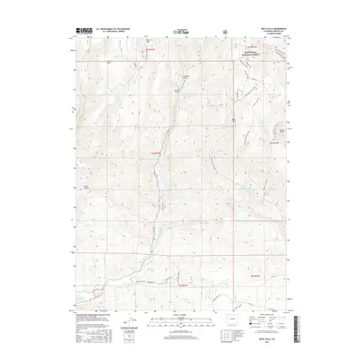
2016 Map of Rifle Falls
USGS Topo · Published 2016About this map
White River National Forest lands dominate the northern and eastern portions of this Garfield County landscape, where the high elevation Coulter Mesa and Long Park descend into a complex network of gulches and draws. Water management is a primary feature of the terrain, visible through the Grass Valley Canal and the southern Rifle Gap Reservoir. The small settlement at Elk Park serves as a local point of reference in the valley floor, surrounded by the paths of E Rifle Cr and Dry Rifle Cr.
Find a feature on this map
48 named features on this map. Tap any name to fly to it.
Don’t see what you’re looking for? This feature index may not catch every label — zoom into the map to look around manually.
Map Details
Editions of this 2016 Rifle Falls Map
This is the sole edition of this map. No revisions or reprints were ever made.
Other maps of this area

1906 · Grand Hogback
USGS Topo · 1:125,000

1910 · Grand Hogback
USGS Topo · 1:125,000

1952 · Horse Mountain
USGS Topo · 1:24,000

1952 · Rifle
USGS Topo · 1:24,000

1957 · Leadville
USGS Topo · 1:250,000

1959 · Leadville
USGS Topo · 1:250,000

1960 · Leadville
USGS Topo · 1:250,000

1962 · Leadville
USGS Topo · 1:250,000

1962 · New Castle
USGS Topo · 1:24,000
1962 · Silt
USGS Topo · 1:24,000