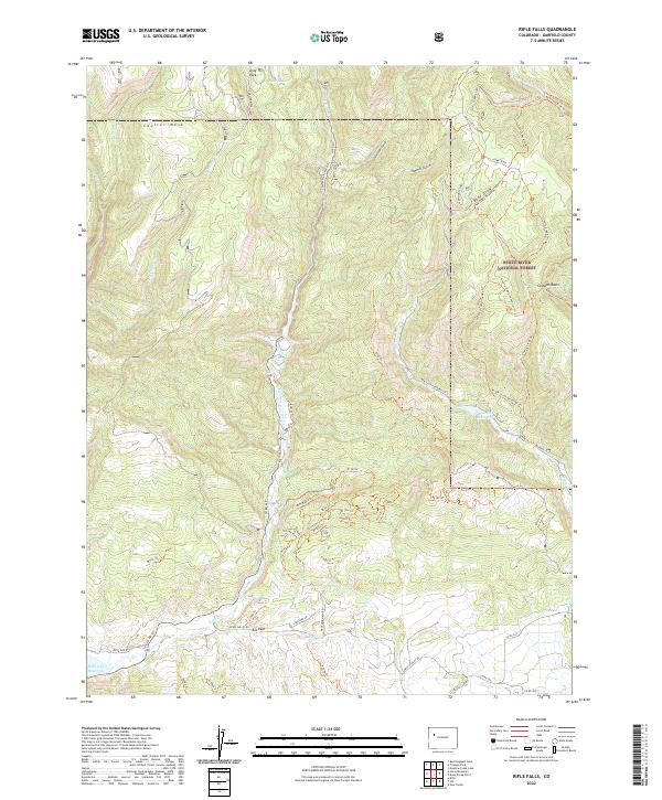
2022 Map of Rifle Falls
USGS Topo · Published 2022About this map
The drainage of E Rifle Cr and Dial Rifle Cr defines this reach of the western slope, where the high plateau of Coulter Mesa meets the managed timber and recreation lands of the White River National Forest. The landscape is a network of historic access routes, from the main New Castle - Buford Rd to functional transit paths like the W. Elk Stock Driveway Trl and the Cherry Creek Connector Trl. At the southern edge of the survey, the Rifle Gap Reservoir provides a significant water management landmark below the settlement area of Elk Park. This map details the complex system of forest roads and trails, such as the Fayville Ohv Trl and the Snowmobile Shed at the head of Beef Draw, reflecting the area's transition from stock driving and resource extraction to modern recreational use.
Find a feature on this map
105 named features on this map. Tap any name to fly to it.
Don’t see what you’re looking for? This feature index may not catch every label — zoom into the map to look around manually.
Map Details
Editions of this 2022 Rifle Falls Map
This is the sole edition of this map. No revisions or reprints were ever made.
Other maps of this area

1906 · Grand Hogback
USGS Topo · 1:125,000

1910 · Grand Hogback
USGS Topo · 1:125,000

1952 · Horse Mountain
USGS Topo · 1:24,000

1952 · Rifle
USGS Topo · 1:24,000

1957 · Leadville
USGS Topo · 1:250,000

1959 · Leadville
USGS Topo · 1:250,000

1960 · Leadville
USGS Topo · 1:250,000

1962 · Leadville
USGS Topo · 1:250,000

1962 · New Castle
USGS Topo · 1:24,000
1962 · Silt
USGS Topo · 1:24,000