2024 Map of Rigby
USGS Topo · Published 2024About this map
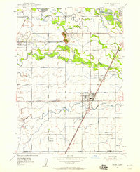
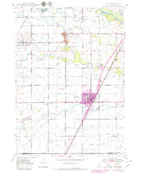
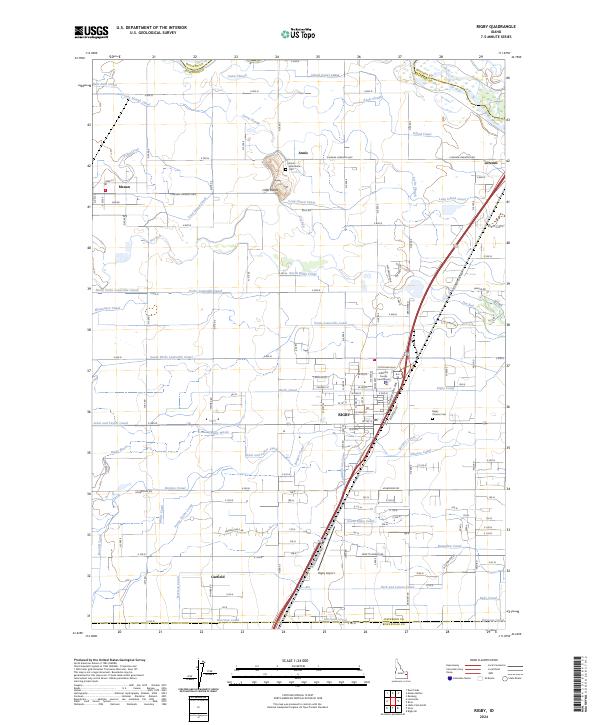
Rigby serves as a central hub in this modern topographic study, showing a landscape defined by an intricate network of irrigation and water management. The city's grid is anchored by the Jefferson County Courthouse and extends toward the Rigby Pioneer Cem and the Rigby Airport. This region of Jefferson County is characterized by its agricultural engineering, with dozens of named waterways such as the Rigby Canal, Burgess Canal, and Long Island Canal branching out to support the surrounding plains. To the north, the terrain is punctuated by the Little Buttes near the settlement of Annis. The Snake River crosses the northeast corner near Lorenzo, where it interacts with the Annis Slough and Island Canal. This map reveals how the modern towns of Menan and Garfield are deeply integrated into a managed riparian system that has sustained the eastern Snake River Plain for generations.
Find a feature on this map
109 named features on this map. Tap any name to fly to it.
Don’t see what you’re looking for? This feature index may not catch every label — zoom into the map to look around manually.
Map Details
Editions of this 2024 Rigby Map
This is the sole edition of this map. No revisions or reprints were ever made.
Historical Maps of Menan Through Time
4 maps found