
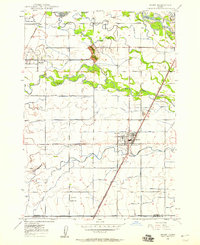
1950 Map of Rigby
USGS Topo · Published 1953About this map
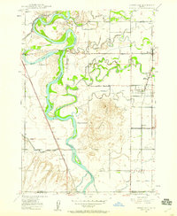
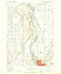
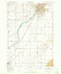
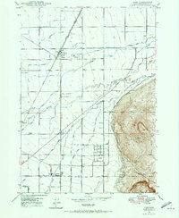
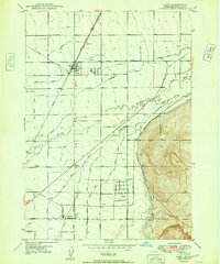
The Snake River corridor and its complex irrigation network dominate this mid-century portrait of southeastern Idaho. Centered on Rigby, the map details a landscape transformed by water engineering, where numerous canals like the Harrison Canal, Burgess Canal, and Enterprise Canal diverge from the river to support the surrounding agriculture. The Union Pacific rail lines and the Yellowstone Highway provide the primary transit arteries connecting rural communities such as Ucon, Iona, and Ririe.
Find a feature on this map
88 named features on this map. Tap any name to fly to it.
Don’t see what you’re looking for? This feature index may not catch every label — zoom into the map to look around manually.
Map Details
Editions of this 1950 Rigby Map
This is the sole edition of this map. No revisions or reprints were ever made.
Other maps of this area

1924 · Hell Creek
USGS Topo · 1:62,500

1924 · Ammon
USGS Topo · 1:62,500

1926 · Hell Creek
USGS Topo · 1:62,500
1948 · Rigby
USGS Topo · 1:24,000
1948 · Lewisville
USGS Topo · 1:24,000
1948 · Idaho Falls North
USGS Topo · 1:24,000
1948 · Idaho Falls South
USGS Topo · 1:24,000
1948 · Ucon
USGS Topo · 1:24,000
1949 · Ucon
USGS Topo · 1:24,000

1949 · Idaho Falls North
USGS Topo · 1:24,000