
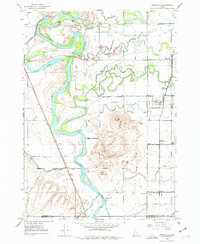
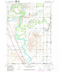
1948 Map of Lewisville
USGS Topo · Published 1959About this map
The Snake River dominates this post-war landscape, carving a serpentine path through the eastern Idaho agricultural plains. This era reveals a sophisticated network of irrigation, where the Big Six Canal, Independent Canal, and Great Western Canal divert water to support a series of rural farming communities. The settlement pattern is anchored by small towns like Lewisville and Roberts, which were vital hubs for the surrounding farming families.
Find a feature on this map
34 named features on this map. Tap any name to fly to it.
Don’t see what you’re looking for? This feature index may not catch every label — zoom into the map to look around manually.
Map Details
Editions of this 1948 Lewisville Map
3 editions found
Other maps of this area

1948 · Rigby
USGS Topo · 1:24,000

1948 · Idaho Falls North
USGS Topo · 1:24,000

1948 · Ucon
USGS Topo · 1:24,000

1949 · Ucon
USGS Topo · 1:24,000

1949 · Idaho Falls North
USGS Topo · 1:24,000

1949 · Rigby
USGS Topo · 1:24,000

1949 · Lewisville
USGS Topo · 1:24,000

1949 · Roberts
USGS Topo · 1:62,500

1949 · Roberts
USGS Topo · 1:24,000

1949 · Shattuck Butte
USGS Topo · 1:24,000