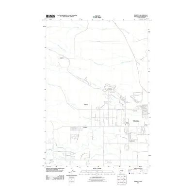
2011 Map of Rimrock
USGS Topo · Published 2011About this map
Billings expands westward into the foothills in this 2011 survey, where the suburban grid meets the drainage networks of the Yellowstone River valley. Small settlements like Rimrock and Baseline are situated near the transition from residential developments to agricultural lands, with the Stewart Ranch marking the rural edge. The landscape is defined by its hydrology, ranging from the managed flow of the Cove Ditch to the natural wandering of Canyon Creek and South Fork Alkali Creek. A concentration of sports-themed residential streets, such as Sam Snead Trl and Bobby Jones Blvd, highlights the modern character of the neighborhoods surrounding the Billings Fire Dept Sta 7. Further out, names like Iran Spring and Dusty Creek reflect the more arid, open terrain that characterizes this part of Yellowstone County.
Find a feature on this map
72 named features on this map. Tap any name to fly to it.
Don’t see what you’re looking for? This feature index may not catch every label — zoom into the map to look around manually.
Map Details
Editions of this 2011 Rimrock Map
This is the sole edition of this map. No revisions or reprints were ever made.
Other maps of this area

1954 · Billings
USGS Topo · 1:250,000

1956 · Comanche
USGS Topo · 1:24,000

1956 · Acton
USGS Topo · 1:24,000

1956 · Hickson Ranch
USGS Topo · 1:24,000

1956 · Rimrock
USGS Topo · 1:24,000

1956 · Two Pine School
USGS Topo · 1:24,000

1956 · Laurel
USGS Topo · 1:24,000

1956 · Yegen
USGS Topo · 1:24,000

1956 · Mossmain
USGS Topo · 1:24,000

1957 · Billings
USGS Topo · 1:250,000