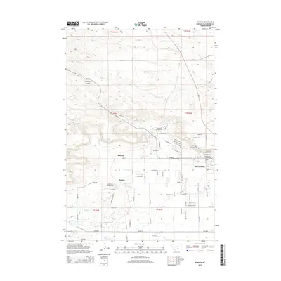
2014 Map of Rimrock
USGS Topo · Published 2014About this map
Billings expands westward into the high plains of Yellowstone County, where the dramatic geological benches known as the Rimrocks define the local topography. This 2014 survey captures the transition from the city's residential grid—evidenced by streets like Poly Dr and Grand Ave—to the open rangelands and coulees of the Rimrock area. The landscape is a network of ephemeral drainages, including S Fork Alkali Cr and N Fork Alkali Cr, which wind through a terrain marked by numerous ranching-related roads such as Shorthorn Dr and Angus Ave.
Find a feature on this map
73 named features on this map. Tap any name to fly to it.
Don’t see what you’re looking for? This feature index may not catch every label — zoom into the map to look around manually.
Map Details
Editions of this 2014 Rimrock Map
This is the sole edition of this map. No revisions or reprints were ever made.
Other maps of this area

1954 · Billings
USGS Topo · 1:250,000

1956 · Comanche
USGS Topo · 1:24,000

1956 · Acton
USGS Topo · 1:24,000

1956 · Hickson Ranch
USGS Topo · 1:24,000

1956 · Rimrock
USGS Topo · 1:24,000

1956 · Two Pine School
USGS Topo · 1:24,000

1956 · Laurel
USGS Topo · 1:24,000

1956 · Yegen
USGS Topo · 1:24,000

1956 · Mossmain
USGS Topo · 1:24,000

1957 · Billings
USGS Topo · 1:250,000