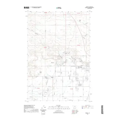
2020 Map of Rimrock
USGS Topo · Published 2020About this map
Billings and the residential expansion of the Rimrocks area define the southern half of this landscape, where the urban grid meets the dramatic sandstone escarpments of Yellowstone County. To the north, the terrain transitions into a series of drainages including N Fork Alkali Cr and S Fork Alkali Cr, interspersed with numerous private airfields such as Haynes Ranch Airport and Skywagon Ranch Airport. The suburban development is noted by a dense network of streets named for golf legends and local geography, while the irrigation history of the region is traced through the Cove Ditch and its proximity to Cove Cr. Significant public space is preserved at Phipps Park, anchoring the central portion of the map where the elevation shifts toward the high plains. The settlement of Baseline and the winding course of Hogans Slough provide further points of interest for those studying the 21st-century growth of this Montana hub.
Find a feature on this map
80 named features on this map. Tap any name to fly to it.
Don’t see what you’re looking for? This feature index may not catch every label — zoom into the map to look around manually.
Map Details
Editions of this 2020 Rimrock Map
This is the sole edition of this map. No revisions or reprints were ever made.
Other maps of this area

1954 · Billings
USGS Topo · 1:250,000

1956 · Comanche
USGS Topo · 1:24,000

1956 · Acton
USGS Topo · 1:24,000

1956 · Hickson Ranch
USGS Topo · 1:24,000

1956 · Rimrock
USGS Topo · 1:24,000

1956 · Two Pine School
USGS Topo · 1:24,000

1956 · Laurel
USGS Topo · 1:24,000

1956 · Yegen
USGS Topo · 1:24,000

1956 · Mossmain
USGS Topo · 1:24,000

1957 · Billings
USGS Topo · 1:250,000