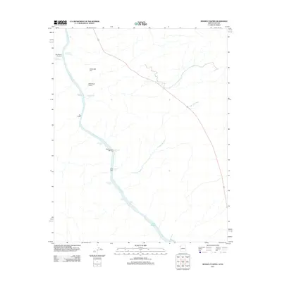
2011 Map of Ringbolt Rapids
USGS Topo · Published 2011About this map
The Colorado River carves a path through the Black Canyon in this 2011 survey, marking the border between Arizona and Nevada. This stretch of river is defined by its turbulent waters, featuring a succession of natural hazards including Ringbolt Rapids, Cross Current Rapids, and Horseshoe Rapids. The desert landscape is punctuated by thermal features like Lost Man Hot Spring and Ringbolt Hot Spring, which suggest the geothermal activity present along the canyon floor. Notable landforms such as Liberty Bell Arch and the narrow passage of The Chute rise above the waterway, while the southern portion of the map shows the river widening into Lake Mohave. The presence of Cranes Nest Wash and White Rock Canyon illustrates the complex drainage systems that feed into the main river channel, providing a clear picture of the topography before these waters reach the dammed reservoirs downstream.
Find a feature on this map
19 named features on this map. Tap any name to fly to it.
Don’t see what you’re looking for? This feature index may not catch every label — zoom into the map to look around manually.
Map Details
Editions of this 2011 Ringbolt Rapids Map
This is the sole edition of this map. No revisions or reprints were ever made.
Other maps of this area

1886 · Camp Mohave
USGS Topo · 1:250,000

1886 · Saint Thomas
USGS Topo · 1:250,000

1892 · Camp Mohave
USGS Topo · 1:250,000

1893 · Saint Thomas
USGS Topo · 1:250,000

1926 · Nelson
USGS Topo · 1:96,000

1926 · Boulder Canyon
USGS Topo · 1:96,000

1942 · Camp Mohave
USGS Topo · 1:250,000

1947 · Kingman
USGS Topo · 1:250,000

1948 · Kingman
USGS Topo · 1:250,000

1952 · Henderson
USGS Topo · 1:62,500