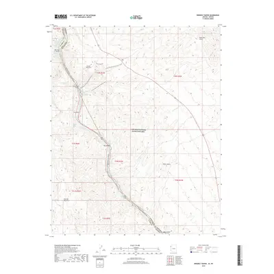
2018 Map of Ringbolt Rapids
USGS Topo · Published 2018About this map
The Colorado River carves through the dramatic geology of the Lake-Mead National Recreation Area on this 2018 survey of the borderlands between Nevada and Arizona. This map details the river's path through Black Canyon, highlighting the complex network of geothermal features and drainages that define the local topography. Hikers and boaters can trace the Black Canyon National Water Trail (Water) alongside several remote springs such as Ringbolt Hot Spring and Lost Man Hot Spring. The landscape is dominated by the Eldorado Mountains and the arid reaches of the Mojave Desert, where rugged washes like Cranes Nest Wash lead toward the river's edge. Notable natural landmarks including Liberty Bell Arch and White Rock Canyon emphasize the extreme elevation changes between the riverbank and the high desert plateaus.
Find a feature on this map
38 named features on this map. Tap any name to fly to it.
Don’t see what you’re looking for? This feature index may not catch every label — zoom into the map to look around manually.
Map Details
Editions of this 2018 Ringbolt Rapids Map
This is the sole edition of this map. No revisions or reprints were ever made.
Other maps of this area

1886 · Camp Mohave
USGS Topo · 1:250,000

1886 · Saint Thomas
USGS Topo · 1:250,000

1892 · Camp Mohave
USGS Topo · 1:250,000

1893 · Saint Thomas
USGS Topo · 1:250,000

1926 · Nelson
USGS Topo · 1:96,000

1926 · Boulder Canyon
USGS Topo · 1:96,000

1942 · Camp Mohave
USGS Topo · 1:250,000

1947 · Kingman
USGS Topo · 1:250,000

1948 · Kingman
USGS Topo · 1:250,000

1952 · Henderson
USGS Topo · 1:62,500