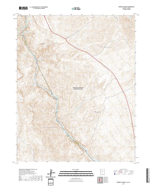
2021 Map of Ringbolt Rapids
USGS Topo · Published 2021About this map
The Colorado River carves a deep path through the Black Mountains and Eldorado Mountains in this modern survey of the border between Nevada and Arizona. This stretch of Black Canyon is defined by its geothermal activity and river navigation hazards, featuring several notable thermal sites such as Ringbolt Hot Spring and Two Mile Hot Spring. The landscape transitions from the high peaks of the Mojave Desert down to the water's edge, where the Black Canyon National Water Trail follows the river's course past Ringbolt Rapids and Crane Nest Rapids.
Find a feature on this map
42 named features on this map. Tap any name to fly to it.
Don’t see what you’re looking for? This feature index may not catch every label — zoom into the map to look around manually.
Map Details
Editions of this 2021 Ringbolt Rapids Map
This is the sole edition of this map. No revisions or reprints were ever made.
Other maps of this area

1886 · Camp Mohave
USGS Topo · 1:250,000

1886 · Saint Thomas
USGS Topo · 1:250,000

1892 · Camp Mohave
USGS Topo · 1:250,000

1893 · Saint Thomas
USGS Topo · 1:250,000

1926 · Nelson
USGS Topo · 1:96,000

1926 · Boulder Canyon
USGS Topo · 1:96,000

1942 · Camp Mohave
USGS Topo · 1:250,000

1947 · Kingman
USGS Topo · 1:250,000

1948 · Kingman
USGS Topo · 1:250,000

1952 · Henderson
USGS Topo · 1:62,500