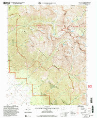
2001 Map of Rio Alto Peak
USGS Topo · Published 2005About this map
Rito Alto Peak stands at the center of this high-altitude survey of the Sangre De Cristo Wilderness, where the jagged ridgeline defines the boundary between Saguache and Custer counties. This landscape is a complex network of glacial basins and alpine lakes, including Cherry Lake, Elaine Lake, and the Goodwin Lakes. The transition from the high peaks of Eureka Mountain and Venable Peak down to the valley floor reveals a history of land management and extraction. To the west, the Crestone Cem and a nearby Gravel Pit sit near the edge of the Rio Grande National Forest. The map documents numerous trails used for backcountry access, such as the San Isabel Trail and Crestone Trail, alongside a small Mine located near North Fork Crestone Creek.
Find a feature on this map
52 named features on this map. Tap any name to fly to it.
Don’t see what you’re looking for? This feature index may not catch every label — zoom into the map to look around manually.
Map Details
Editions of this 2001 Rio Alto Peak Map
This is the sole edition of this map. No revisions or reprints were ever made.
Other maps of this area

1950 · Valley View Hot Springs
USGS Topo · 1:24,000

1954 · Trinidad
USGS Topo · 1:250,000

1954 · Pueblo
USGS Topo · 1:250,000

1955 · Trinidad
USGS Topo · 1:250,000

1957 · Pueblo
USGS Topo · 1:250,000

1958 · Trinidad
USGS Topo · 1:250,000

1958 · Pueblo
USGS Topo · 1:250,000

1958 · Beckwith Mountain
USGS Topo · 1:24,000

1959 · Trinidad
USGS Topo · 1:250,000

1959 · Electric Peak
USGS Topo · 1:62,500