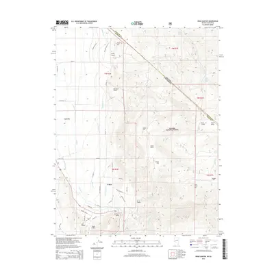
2014 Map of Risue Canyon
USGS Topo · Published 2014About this map
The West Walker River corridor defines this portion of the Eastern Sierra, where the California and Nevada state line cuts diagonally across the high desert terrain. Settlements like Walker and Coleville are situated within the fertile Antelope Valley, supported by a complex network of irrigation infrastructure including the Lone Company Ditch, Highline Ditch, and Main Canal. This water management system illustrates the intensive agricultural effort required to sustain these mountain valley communities. East of the valley, the landscape rises into the Toiyabe National Forest, characterized by high-elevation features such as Wild Horse Mtn and Salmon Flat. The map also captures the transition from Mono County into Douglas County, documenting several remote springs and canyons like Risue Canyon and Jackass Cr that have long served as vital water sources for ranching and forest management.
Find a feature on this map
56 named features on this map. Tap any name to fly to it.
Don’t see what you’re looking for? This feature index may not catch every label — zoom into the map to look around manually.
Map Details
Editions of this 2014 Risue Canyon Map
This is the sole edition of this map. No revisions or reprints were ever made.
Other maps of this area

1889 · Markleeville
USGS Topo · 1:125,000

1891 · Markleeville
USGS Topo · 1:125,000

1891 · Wellington
USGS Topo · 1:125,000

1893 · Markleeville
USGS Topo · 1:125,000

1893 · Wellington
USGS Topo · 1:125,000

1896 · Dardanelles
USGS Topo · 1:125,000

1898 · Dardanelles
USGS Topo · 1:125,000

1909 · Bridgeport
USGS Topo · 1:125,000

1911 · Bridgeport
USGS Topo · 1:125,000

1920 · Bridgeport
USGS Topo · 1:125,000