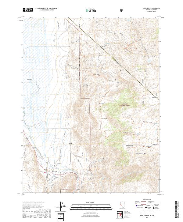
2021 Map of Risue Canyon
USGS Topo · Published 2021About this map
The settlement of Walker sits at the edge of the Antelope Valley, where the West Walker River meets a network of irrigation works including the Highline Ditch, Lone Company Ditch, and Main Canal. This area on the Nevada-California border shows the intersection of high-desert agriculture and the rising peaks of the Sweetwater Mountains. The landscape transitions from the river bottom and the Big Slough into the protected lands of the Toiyabe National Forest.
Find a feature on this map
72 named features on this map. Tap any name to fly to it.
Don’t see what you’re looking for? This feature index may not catch every label — zoom into the map to look around manually.
Map Details
Editions of this 2021 Risue Canyon Map
This is the sole edition of this map. No revisions or reprints were ever made.
Other maps of this area

1889 · Markleeville
USGS Topo · 1:125,000

1891 · Markleeville
USGS Topo · 1:125,000

1891 · Wellington
USGS Topo · 1:125,000

1893 · Markleeville
USGS Topo · 1:125,000

1893 · Wellington
USGS Topo · 1:125,000

1896 · Dardanelles
USGS Topo · 1:125,000

1898 · Dardanelles
USGS Topo · 1:125,000

1909 · Bridgeport
USGS Topo · 1:125,000

1911 · Bridgeport
USGS Topo · 1:125,000

1920 · Bridgeport
USGS Topo · 1:125,000