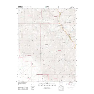
2013 Map of Rito Alto Peak
USGS Topo · Published 2013About this map
Rito Alto Peak anchors this high-elevation landscape along the border of Saguache Co and Custer Co, where the ridge lines of the Sangre de Cristo Mountains separate the San Isabel National Forest from the Rio Grande National Forest. The map documents a network of alpine trails and high passes, including Hermit Pass and Rito Alto Trail 745, which connect numerous glacial basins. Evidence of early land claims remains visible at the King Homestead and Hutchinson Homestead in the lower elevations near San Isabel Cr. The terrain is defined by dramatic vertical relief, from the low reaches of Dry Gulch to the summits of Eureka Mountain and Venable Peak. For those interested in the hydrology of the range, the sheet traces several high-altitude water bodies such as San Isabel Lake, Eureka Lake, and Mas Alto Lake.
Find a feature on this map
58 named features on this map. Tap any name to fly to it.
Don’t see what you’re looking for? This feature index may not catch every label — zoom into the map to look around manually.
Map Details
Editions of this 2013 Rito Alto Peak Map
This is the sole edition of this map. No revisions or reprints were ever made.
Other maps of this area

1950 · Valley View Hot Springs
USGS Topo · 1:24,000

1954 · Trinidad
USGS Topo · 1:250,000

1954 · Pueblo
USGS Topo · 1:250,000

1955 · Trinidad
USGS Topo · 1:250,000

1957 · Pueblo
USGS Topo · 1:250,000

1958 · Trinidad
USGS Topo · 1:250,000

1958 · Pueblo
USGS Topo · 1:250,000

1958 · Beckwith Mountain
USGS Topo · 1:24,000

1959 · Trinidad
USGS Topo · 1:250,000

1959 · Electric Peak
USGS Topo · 1:62,500