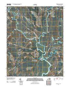
2010 Map of Riverdale
USGS Topo · Published 2010About this map
The Chowan River and its major tributaries, the Nottoway River and Blackwater River, define this landscape at the border of Virginia and North Carolina. The abundance of river landings, such as Milk Landing, Cox Landing, and Sandy Landing, points to a long-standing reliance on these waterways for transport and commerce. Small settlements like Riverdale and Riddicksville are situated amidst a network of creeks and branches, including Buckhorn Creek and Somerton Creek.
Find a feature on this map
52 named features on this map. Tap any name to fly to it.
Don’t see what you’re looking for? This feature index may not catch every label — zoom into the map to look around manually.
Map Details
Editions of this 2010 Riverdale Map
This is the sole edition of this map. No revisions or reprints were ever made.
Other maps of this area

1908 · Winton
USGS Topo · 1:62,500

1919 · Boykins
USGS Topo · 1:48,000

1920 · Holland
USGS Topo · 1:62,500

1920 · Boykins
USGS Topo · 1:62,500

1943 · Holland
USGS Topo · 1:62,500

1953 · Norfolk
USGS Topo · 1:250,000

1957 · Holland
USGS Topo · 1:62,500

1966 · Sunbeam
USGS Topo · 1:24,000
1967 · Courtland
USGS Topo · 1:24,000
1967 · Franklin
USGS Topo · 1:24,000