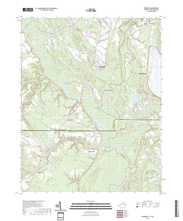
2022 Map of Riverdale
USGS Topo · Published 2022About this map
The Nottoway River and Blackwater River converge in this low-lying borderland between Virginia and North Carolina, where the landscape is defined by vast wetland systems and river bends. Small rural settlements like Riddicksville and Riverdale are connected by a network of local routes including Smiths Ferry Rd and Riverdale Dr. The topography is notably flat, characterized by intricate drainage patterns such as Buckhorn Creek and Somerton Creek.
Find a feature on this map
56 named features on this map. Tap any name to fly to it.
Don’t see what you’re looking for? This feature index may not catch every label — zoom into the map to look around manually.
Map Details
Editions of this 2022 Riverdale Map
This is the sole edition of this map. No revisions or reprints were ever made.
Other maps of this area

1908 · Winton
USGS Topo · 1:62,500

1919 · Boykins
USGS Topo · 1:48,000

1920 · Holland
USGS Topo · 1:62,500

1920 · Boykins
USGS Topo · 1:62,500

1943 · Holland
USGS Topo · 1:62,500

1953 · Norfolk
USGS Topo · 1:250,000

1957 · Holland
USGS Topo · 1:62,500

1966 · Sunbeam
USGS Topo · 1:24,000
1967 · Courtland
USGS Topo · 1:24,000
1967 · Franklin
USGS Topo · 1:24,000