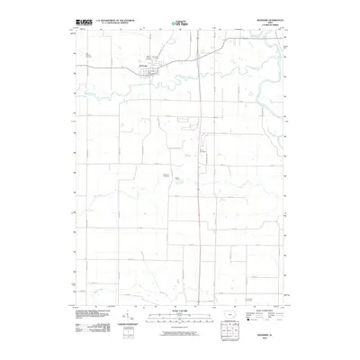
2010 Map of Riverside
USGS Topo · Published 2010About this map
The Riverside settlement in Washington County serves as the focal point of this northern Iowa landscape, where the English River joins the Iowa River in a complex of meandering waterways. The town center is well-defined by the Riverside Post Office and nearby communal grounds, including the Riverside Cemetery and Mount Olivet Cemetery. This area reflects a long-standing agricultural and rural social structure, evidenced by the numerous burial grounds distributed across the township.
Find a feature on this map
39 named features on this map. Tap any name to fly to it.
Don’t see what you’re looking for? This feature index may not catch every label — zoom into the map to look around manually.
Map Details
Editions of this 2010 Riverside Map
This is the sole edition of this map. No revisions or reprints were ever made.
Other maps of this area

1891 · Iowa City
USGS Topo · 1:62,500

1894 · West Liberty
USGS Topo · 1:62,500

1901 · Stanwood
USGS Topo · 1:125,000

1903 · Fairfax
USGS Topo · 1:125,000

1938 · Iowa City
USGS Topo · 1:62,500

1958 · Davenport
USGS Topo · 1:250,000

1961 · Davenport
USGS Topo · 1:250,000

1962 · Davenport
USGS Topo · 1:250,000

1965 · Williamstown
USGS Topo · 1:24,000
1965 · West Liberty SW
USGS Topo · 1:24,000