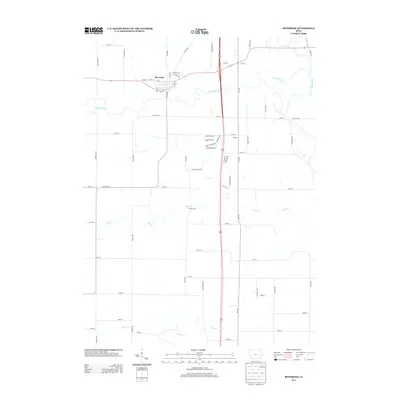
2013 Map of Riverside
USGS Topo · Published 2013About this map
Riverside sits at the northern edge of this quadrangle, its grid plan bound by River St and Palm St near the meandering English River. The landscape is defined by the convergence of several waterways, including the Iowa River and Davis Creek, which carve through the agricultural countryside south of town. While the town itself shows established residential streets like Pioneer St and Sycamore St, the outlying areas near Yalton and along Underwood Ave reflect modern residential expansion with named subdivisions and lanes such as Hidden Meadow Ln and Rhine Stone Dr. This 2013 survey illustrates the intersection of traditional river-bottom topography and the evolving rural infrastructure of Washington County, connected by a network of gravel and paved roads including Co Hwy G16 and Old Captains Rd.
Find a feature on this map
54 named features on this map. Tap any name to fly to it.
Don’t see what you’re looking for? This feature index may not catch every label — zoom into the map to look around manually.
Map Details
Editions of this 2013 Riverside Map
This is the sole edition of this map. No revisions or reprints were ever made.
Other maps of this area

1891 · Iowa City
USGS Topo · 1:62,500

1894 · West Liberty
USGS Topo · 1:62,500

1901 · Stanwood
USGS Topo · 1:125,000

1903 · Fairfax
USGS Topo · 1:125,000

1938 · Iowa City
USGS Topo · 1:62,500

1958 · Davenport
USGS Topo · 1:250,000

1961 · Davenport
USGS Topo · 1:250,000

1962 · Davenport
USGS Topo · 1:250,000

1965 · Williamstown
USGS Topo · 1:24,000
1965 · West Liberty SW
USGS Topo · 1:24,000