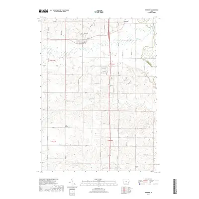
2018 Map of Riverside
USGS Topo · Published 2018About this map
Riverside sits prominently at the confluence of the English River and the Iowa River, serving as a central hub for the surrounding rural agricultural landscape. This 2018 survey reveals a territory marked by a significant number of family and community burial grounds, including the Saint Vincent Cem, Mount Olivet Cem, and the Riverside Cem. These sites, along with the Patterson Cem and Locust Grove Cem, provide essential anchor points for genealogical research in Washington and Johnson Counties. The grid-like road network, featuring routes like Tulip Ave and Vine Ave, partitions the rolling terrain between active creek drainages like Davis Cr and Goose Cr. Further south, the map identifies Pfeifer Field and the Harrisburg Cem, illustrating the enduring nature of local landmarks in this corner of Iowa.
Find a feature on this map
65 named features on this map. Tap any name to fly to it.
Don’t see what you’re looking for? This feature index may not catch every label — zoom into the map to look around manually.
Map Details
Editions of this 2018 Riverside Map
This is the sole edition of this map. No revisions or reprints were ever made.
Other maps of this area

1891 · Iowa City
USGS Topo · 1:62,500

1894 · West Liberty
USGS Topo · 1:62,500

1901 · Stanwood
USGS Topo · 1:125,000

1903 · Fairfax
USGS Topo · 1:125,000

1938 · Iowa City
USGS Topo · 1:62,500

1958 · Davenport
USGS Topo · 1:250,000

1961 · Davenport
USGS Topo · 1:250,000

1962 · Davenport
USGS Topo · 1:250,000

1965 · Williamstown
USGS Topo · 1:24,000
1965 · West Liberty SW
USGS Topo · 1:24,000