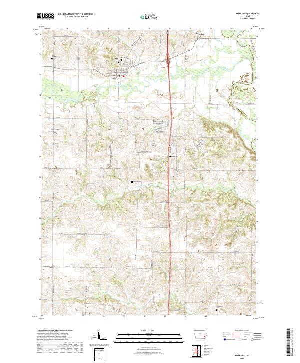
2022 Map of Riverside
USGS Topo · Published 2022About this map
Riverside sits at the confluence where the English River meets the Iowa River, serving as a central hub for the surrounding agricultural townships. The town's grid, featuring streets from 1st St to 4th St, is hemmed in by water to the south and east, creating a distinct boundary between the settlement and the river bottomlands. This area is particularly rich for family history research, as evidenced by the dense concentration of burial sites throughout the landscape, including Saint Vincent Cem, Mount Olivet Cem, and Riverside Cem all clustered near the town site. Further out, the terrain is shaped by several drainages such as Davis Cr and Goose Cr, with rural landmarks like Pfeiffer Field and the Cumberland Havel Cem marking the transition into the higher ground of t76n r7w and t77n r6w.
Find a feature on this map
63 named features on this map. Tap any name to fly to it.
Don’t see what you’re looking for? This feature index may not catch every label — zoom into the map to look around manually.
Map Details
Editions of this 2022 Riverside Map
This is the sole edition of this map. No revisions or reprints were ever made.
Other maps of this area

1891 · Iowa City
USGS Topo · 1:62,500

1894 · West Liberty
USGS Topo · 1:62,500

1901 · Stanwood
USGS Topo · 1:125,000

1903 · Fairfax
USGS Topo · 1:125,000

1938 · Iowa City
USGS Topo · 1:62,500

1958 · Davenport
USGS Topo · 1:250,000

1961 · Davenport
USGS Topo · 1:250,000

1962 · Davenport
USGS Topo · 1:250,000

1965 · Williamstown
USGS Topo · 1:24,000
1965 · West Liberty SW
USGS Topo · 1:24,000