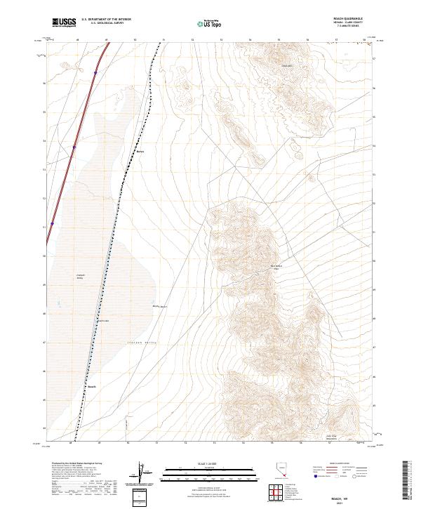
2021 Map of Roach
USGS Topo · Published 2021About this map
Ivanpah Valley dominates this high-desert landscape in Clark County, where the dry expanse of Roach Lake sits at the foot of the Lucy Gray Mountains. This 2021 survey illustrates the stark geography of the Mojave Desert, defined by sharp elevation shifts between the basin floor and prominent landmarks like Beer Bottle Pass and Sheep Mtn. The map highlights the sparse human imprint on this arid corridor, tracing the infrastructure that connects isolated points such as Roach and Borax. These names recall the early industrial and transit history of the region, where rail and road routes follow the path of least resistance through the desert flats. Modern connectivity is represented by E Primm Blvd, which skirts the edge of the dry lake bed in a landscape otherwise shaped by natural landforms and historic surveying boundaries.
Find a feature on this map
15 named features on this map. Tap any name to fly to it.
Don’t see what you’re looking for? This feature index may not catch every label — zoom into the map to look around manually.
Map Details
Editions of this 2021 Roach Map
This is the sole edition of this map. No revisions or reprints were ever made.
Other maps of this area

1910 · Ivanpah
USGS Topo · 1:250,000

1912 · Ivanpah
USGS Topo · 1:250,000

1942 · Ivanpah
USGS Topo · 1:250,000

1947 · Kingman
USGS Topo · 1:250,000

1948 · Kingman
USGS Topo · 1:250,000

1954 · Kingman
USGS Topo · 1:250,000

1955 · Kingman
USGS Topo · 1:250,000

1955 · Roach Lake
USGS Topo · 1:62,500

1958 · Kingman
USGS Topo · 1:250,000

1960 · Kingman
USGS Topo · 1:250,000