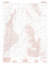
1985 Map of Roach
USGS Topo · Published 1985About this map
Ivanpah Lake and Roach Lake dominate this arid basin, their expansive dry beds providing a stark contrast to the high ridges of the Sheep Mountain and the Lucy Gray Mountains. The transport corridor through the Ivanpah Valley is the primary focus of development here, centered on the Union Pacific railroad line. Small industrial and railway-related hubs like Borax and Roach are situated along the tracks, serving as lonely outposts in the high desert. Beyond the rails, the landscape is defined by rugged elevation changes and resource extraction, visible in the primitive 4wd tracks and scattered Borrow Pits. The presence of a major Pipeline and the high crossing at Beer Bottle Pass illustrate the logistical challenges of moving infrastructure and energy through this steep terrain during the mid-1980s.
Find a feature on this map
15 named features on this map. Tap any name to fly to it.
Don’t see what you’re looking for? This feature index may not catch every label — zoom into the map to look around manually.
Map Details
Editions of this 1985 Roach Map
This is the sole edition of this map. No revisions or reprints were ever made.
Other maps of this area

1910 · Ivanpah
USGS Topo · 1:250,000

1912 · Ivanpah
USGS Topo · 1:250,000

1942 · Ivanpah
USGS Topo · 1:250,000

1947 · Kingman
USGS Topo · 1:250,000

1948 · Kingman
USGS Topo · 1:250,000

1954 · Kingman
USGS Topo · 1:250,000

1955 · Kingman
USGS Topo · 1:250,000

1955 · Roach Lake
USGS Topo · 1:62,500

1958 · Kingman
USGS Topo · 1:250,000

1960 · Kingman
USGS Topo · 1:250,000