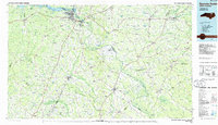
1985 Map of Roanoke Rapids
USGS Topo · Published 1985About this map
The Roanoke River corridor dominates this mid-1980s landscape, serving as a historic divider and connector between numerous North Carolina counties. Near the northern edge, the expansive Lake Gaston gives way to the industrial and hydro-power centers of Roanoke Rapids, Rosemary, and Weldon. The map reveals a complex drainage network where the river's path is marked by distinctive features like Occoneechee Neck and Mush Island. To the south and east, the terrain shifts into a mosaic of wetlands and watercourses, including the Urahaw Swamp and Potecasi Creek.
Find a feature on this map
127 named features on this map. Tap any name to fly to it.
Don’t see what you’re looking for? This feature index may not catch every label — zoom into the map to look around manually.
Map Details
Editions of this 1985 Roanoke Rapids Map
2 editions found
Other maps of this area

1901 · Parmele
USGS Topo · 1:62,500

1901 · Williamston
USGS Topo · 1:62,500

1902 · Williamston
USGS Topo · 1:62,500

1902 · Parmele
USGS Topo · 1:62,500

1902 · Rocky Mount
USGS Topo · 1:62,500

1902 · Spring Hope
USGS Topo · 1:62,500

1902 · Tarboro
USGS Topo · 1:62,500

1903 · Tarboro
USGS Topo · 1:62,500

1904 · Rocky Mount
USGS Topo · 1:62,500

1904 · Springhope
USGS Topo · 1:62,500