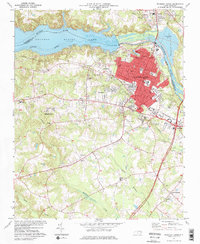
1974 Map of Roanoke Rapids
USGS Topo · Published 1977About this map
Roanoke Rapids and the neighboring industrial centers of Rosemary and Belmont dominate the landscape along the Roanoke River in the mid-1970s. This survey illustrates a period of significant regional infrastructure, showing the Roanoke Rapids Lake and its associated Powerplant and Filtration Plant. The presence of the Roanoke Rapids Air Force Station and the County Airport highlight the area's strategic and logistical importance during this era.
Find a feature on this map
70 named features on this map. Tap any name to fly to it.
Don’t see what you’re looking for? This feature index may not catch every label — zoom into the map to look around manually.
Map Details
Editions of this 1974 Roanoke Rapids Map
2 editions found
Other maps of this area

1919 · White Plains
USGS Topo · 1:48,000

1919 · Emporia
USGS Topo · 1:62,500

1920 · White Plains
USGS Topo · 1:62,500

1942 · Emporia
USGS Topo · 1:62,500

1953 · Norfolk
USGS Topo · 1:250,000

1963 · Skippers
USGS Topo · 1:24,000

1963 · Barley
USGS Topo · 1:24,000

1963 · Valentines
USGS Topo · 1:24,000

1973 · Aurelian Springs
USGS Topo · 1:24,000
1973 · Thelma
USGS Topo · 1:24,000