
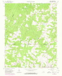
1963 Map of Barley
USGS Topo · Published 1964About this map
The community of Barley sits near the crossing of the Virginia-North Carolina state line, anchoring a landscape defined by small agrarian settlements and rural institutions in the early 1960s. To the south, the town of Gaston is depicted along with a local Drive-in Theater, highlighting mid-century social hubs. The map reveals a dense network of country churches and community markers, including Ebenezer Ch, Jerusalem Ch, and Oak Grove Ch, which served the surrounding farms. This area, spanning Brunswick and Greensville counties in Virginia and Northampton County in North Carolina, shows a landscape shaped by water power and education, evidenced by Garners Mill on Beaverpond Creek and schools like Royland Sch and Squire Sch. The terrain is deeply etched by a complex drainage system including Fontaine Creek and Black Duck Creek.
Find a feature on this map
36 named features on this map. Tap any name to fly to it.
Don’t see what you’re looking for? This feature index may not catch every label — zoom into the map to look around manually.
Map Details
Editions of this 1963 Barley Map
Other maps of this area

1919 · White Plains
USGS Topo · 1:48,000

1919 · Emporia
USGS Topo · 1:62,500

1920 · White Plains
USGS Topo · 1:62,500

1942 · Emporia
USGS Topo · 1:62,500

1953 · Norfolk
USGS Topo · 1:250,000

1963 · Powellton
USGS Topo · 1:24,000

1963 · Skippers
USGS Topo · 1:24,000

1963 · Emporia
USGS Topo · 1:24,000

1963 · Ante
USGS Topo · 1:24,000

1963 · Valentines
USGS Topo · 1:24,000