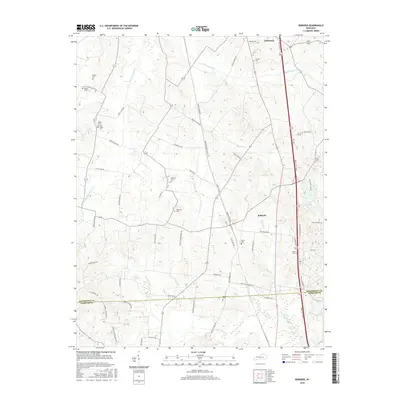
2016 Map of Robards
USGS Topo · Published 2016About this map
The community of Robards and the rural hills of southern Henderson County are defined by a network of drainage creeks and small family cemeteries in this 2016 survey. Near the northern boundary at Anthoston, the landscape transitions into the headwaters of the E Fork Canoe Cr and W Fork Canoe Cr, while the southern reaches cross the Henderson Co Webster Co line. This modern topographic record is particularly valuable for genealogists, as it meticulously identifies numerous small burial sites, including the Denton Cem, McMullin Cem, and the uniquely named Cairo-Hickory Grove Rd Agnew Cem. The infrastructure of the region is anchored by the Breathitt Pkwy corridor and the industrial presence at Alcan Rd, while the naming of Coal Mine Rd near Eakins Cem points to the area's extraction history.
Find a feature on this map
64 named features on this map. Tap any name to fly to it.
Don’t see what you’re looking for? This feature index may not catch every label — zoom into the map to look around manually.
Map Details
Editions of this 2016 Robards Map
This is the sole edition of this map. No revisions or reprints were ever made.
Other maps of this area

1905 · Newburg
USGS Topo · 1:62,500

1906 · Sebree
USGS Topo · 1:62,500

1908 · Calhoun
USGS Topo · 1:62,500

1914 · Henderson
USGS Topo · 1:48,000

1916 · Henderson
USGS Topo · 1:62,500

1949 · Sebree
USGS Topo · 1:24,000

1949 · Poole
USGS Topo · 1:24,000

1949 · Robards
USGS Topo · 1:24,000

1951 · Dixon
USGS Topo · 1:24,000

1951 · Poole
USGS Topo · 1:24,000